Overview
Twenty facilities that imagery analysis, press and professional journals suggest house Uyghur children have been identified in this first study of geolocating China's detention infrastructure targeting Uyghurs and other Muslim minority groups.
This methodology report can help other researchers identify these child detention facilities (mostly from satellite imagery). Other researchers can view this analysis in 3rd-party tools such as Google Earth or ESRI systems. Structured data (Excel and CSV) is also available for download for 3rd-party enhancements or study.
Activity
GEOINT analysis shows steady construction progress at probable Chinese preschool facilities in southern Xinjiang.
China's detention since 2017 of more than one million ethnic Turkic Muslim adults in its northwestern province of Xinjiang has been widely reported and accepted at face value as a matter of US policy, but the fate of the children separated from their parents as a result of these policies has received less coverage. Chinese official press has said the transformation through education facilities for adults teach Chinese language and values, while Western researchers and nongovernmental organizations liken the facilities to internment camps, where the detained adults are subjected to forced indoctrination. The mass removal of parents and other adult extended family members from their homes has resulted in a need to house children. Satellite imagery-based research confirms that construction of new, suspected preschool facilities, which appear to serve the dual purpose of housing and educating children, coincided with the adult detention program, probably to meet the increased childcare needs necessitated by the governments wide-ranging crackdown and core policy of ethnic unity. For its part, China characterizes the construction of both preschools and boarding schools in Xinjiang as part of its poverty alleviation efforts.
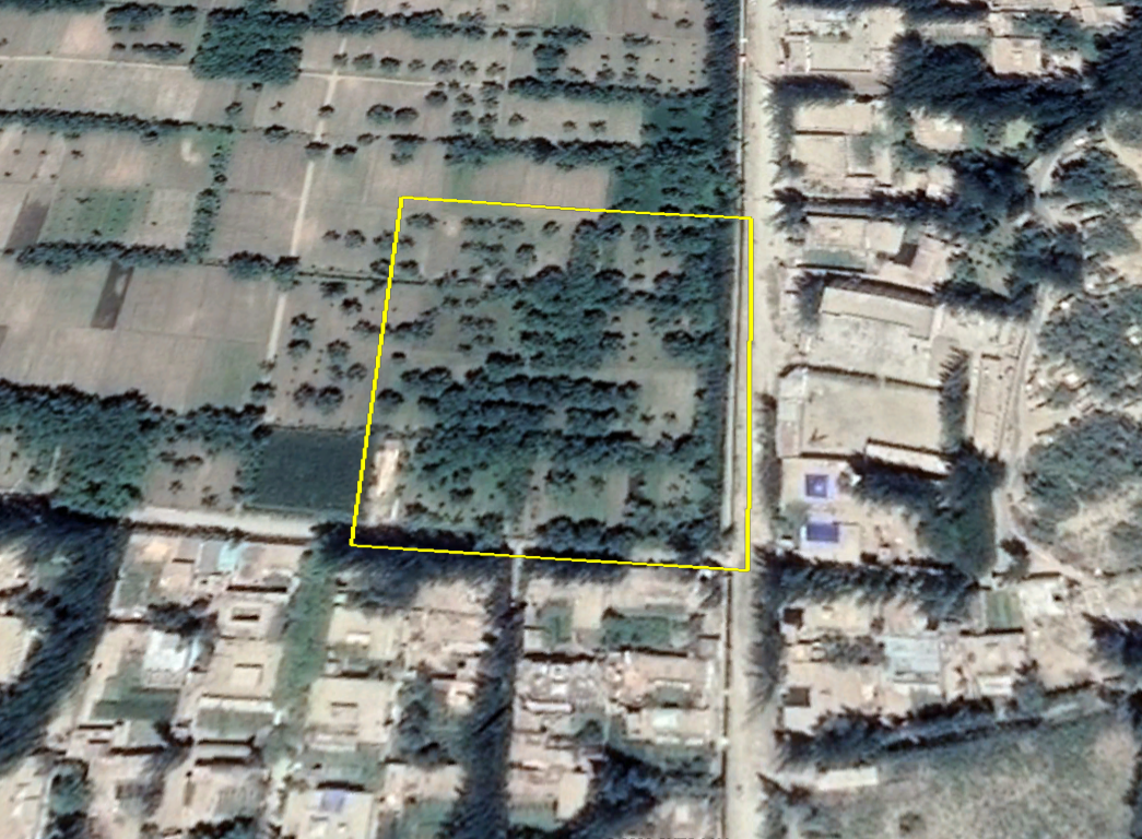
Against this backdrop, RAND researchers, using NGA-funded commercial imagery and methodology reviews, sought to add to the body of research available by performing a satellite imagery search to find examples of suspected preschool facilities. The imagery search was restricted to rural areas the Uyghur-majority city of Hotan because new construction would stand out more there than in urban environments.1 As of July and August 2018, Chinese procurement officials sought to build at least nine structures with enough beds to house about 5,000 children in and around Hotan. Most facilities reportedly include a minimum of 100 beds, with some accommodating much larger capacities. The goal was to identify some of these facilities, characterize them in a narrative and then provide geolocated and structured data of the suspect facilities as foundational data for subsequent research. This work is exploratory, and therefore qualitative; it is intended to be iterative.
To date, RAND, using NGA-funded commercial imagery, has identified kmlHotan Preschool Facility Annotations20 suspect facilities that meet our imagery-based identification criteria, which is informed by other research and reporting. Broadly, the 20 facilities have similar construction timelines, locations, and physical features.
- A majority of the identified facilities were constructed since 2016, which is consistent with the timing cited by other researchers. Their construction coincided with the construction of additional detention facilities, according to Western researchers and media.
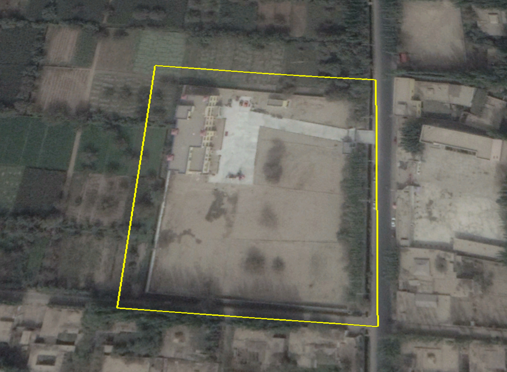
- Many of the structures stand on what was open land or modest homes prior to construction of the multistory structures. Nearly all of the identified newly constructed facilities are in villages on Hotans periphery; this is a result of our methodology, which concentrated the search in these areas.
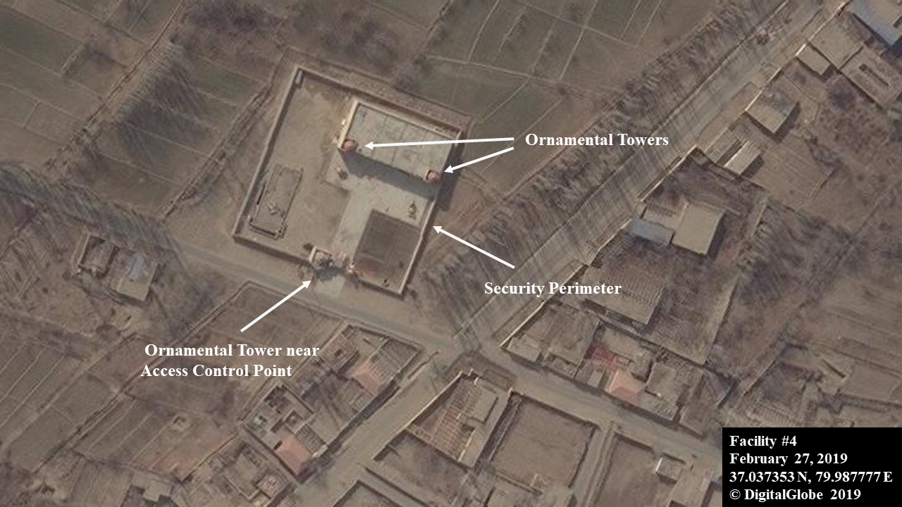
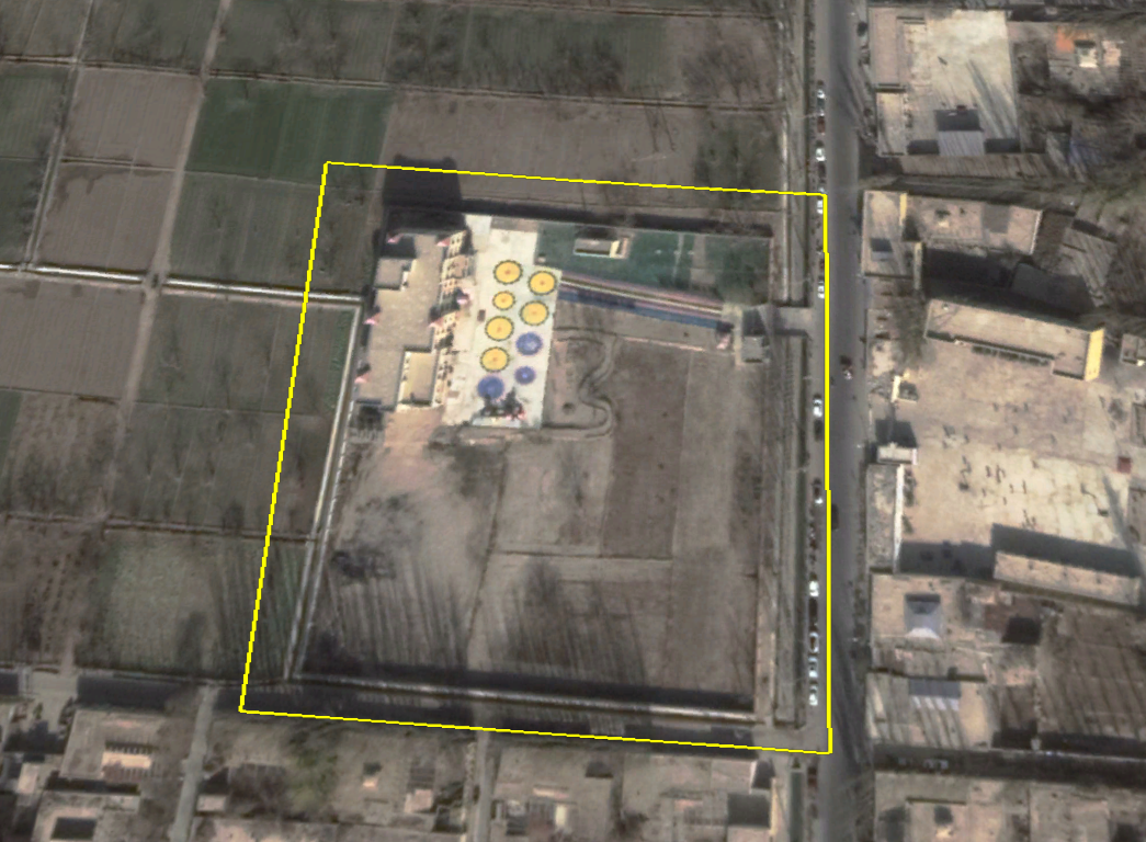
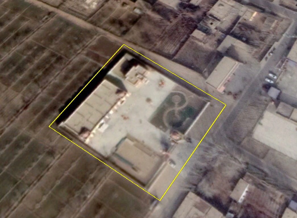
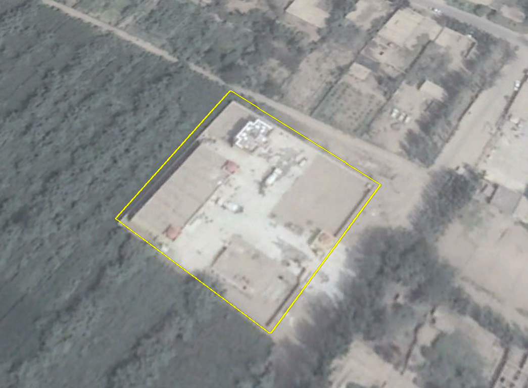
- Physical features. Most of the buildings we identified are approximately 35 meters long by 20 meters wide, while some are only 15 meters wide. They are typically either two or three stories tall, and often brightly colored with ornamental architectural features like castle towers. In some instances, two identical buildings were built on the same lot. Some of the other features that serve as imagery signatures for these facilities include: multiple, sometimes colorful circles that appear to support outdoor play by young children; playground equipment sets; and high walls with only a single security-controlled entry point. There is often another, smaller structure next to the main building which was completed on the same timeline. While a definitive purpose for the smaller structure is unknown, one potential purpose is that it houses security and other administrative staff, as the facility likely is staffed around the clock.
This research does not represent a comprehensive imagery search of all of Xinjiang, which at 660,000 square miles in area is about four times the size of the state of California. Xinjiang authorities in early 2017 reportedly had begun the construction of 4,387 preschools to accommodate 562,900 new students, so this research has identified just a very small percentage of the potential total, and just in rural areas near Hotan. Figures 1-4 below and imagery in the timeline section represent examples of the distinctive features present in newly constructed preschool buildings.
Figure 1: Example of paired preschool buildings completed near Hotan since 2017

Figure 2: Example of preschool with colorful mat/circle characteristic completed near Hotan since 2017
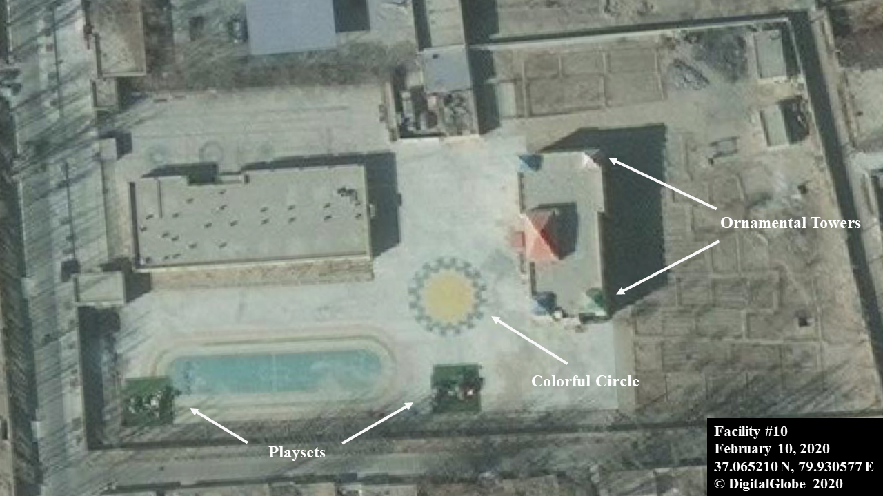
Figure 3: Example of mats/circles with different characteristics
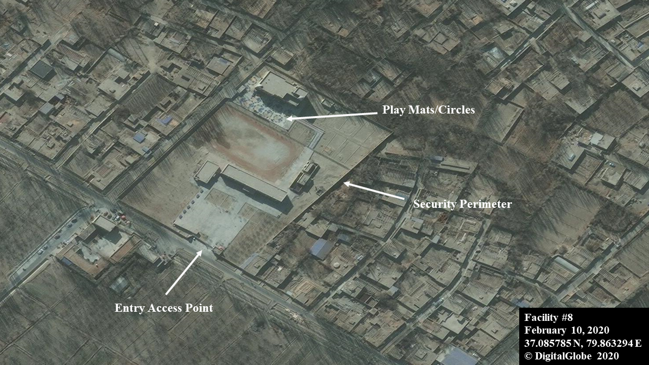
Figure 4: Example of ornamental tower near access control point
References and Notes
- Alternative spelling for Uyghur for Search Engine Optimization (SEO) is Uighur.
Nov 19, 2019
Facility #12 - colorful circles (finished)
Distinct colorful circles (play mats) characteristic. Researchers can apply the satellite imagery characteristics
Feb 26, 2019
Facility #1 - ornamental towers with playground (finished)
Distinct ornamental towers on buildings and near access control point characteristic.Source: Google Earth Historical Layers

Oct 02, 2017
Facility #12 - under construction
Follows general construction pattern from mid-2017.Source: Google Earth Historical Layers

Aug 14, 2017
Facility #1 - under construction
Follows general construction pattern from mid-2017.Source: Google Earth Historical Layers


Jul 03, 2015
Facility #12 - No construction yet
Open field 2015.Source: Google Earth Historical Layers

Look Ahead
This is the first report in a series of geolocation studies to document comprehensively China's detention infrastructure targeting Uyghurs and other Muslim minority groups. Please see "Data Sources" section for other download formats to help with methodology familiarization.
Things to Watch
- ground clearing in rural areas
- ornamental towers near entry access points
- ornamental towers on top of multi-story buildings
- colorful mats and circles
- part 2 of geolocation series coming soon...
About The Authors

Quantitative Analyst, RAND

Senior Advisor, RAND

Methodologies Reviewed by NGA
Publication of this article does not constitute an endorsement of the contents, conclusions, or opinions of the author(s). The published article’s contents, conclusions, and opinions are solely that of the author(s) and are in no way attributable or an endorsement by the National Geospatial-Intelligence Agency, the Department of Defense, the United States Intelligence Community, or the United States Government. For additional information, please see the Tearline Comprehensive Disclaimer at https://www.tearline.mil/disclaimers.